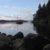
Sea Level Rise
Cortes Currents
English - April 09, 2021 15:03 - 1 minute - 4.52 MBNews cortes island discovery islands quadra food security energy indigenous nations Homepage Download Apple Podcasts Google Podcasts Overcast Castro Pocket Casts RSS feed
Roy L Hales/ Cortes Currents - SRD Protective services Coordinator Shaun Koopman gave an update on the progress of a grant to access the danger of sea level rise on Cortes and Quadra Islands.
“We will find out if we get that around the end of May,” he said.
Lidar data is a key element of flood mapping, and there isn’t any available for Cortes Island right now.
Koopman explained, “So about $40,000 would be spent getting Lidar data for Cortes. Another $40,000 to $50,000 would be spent analyzing the Lidar data for Cortes and Quadra and developing a map that shows sea level rise over time.”
The big ticket items of that grant would be having a consultant look at the vulnerability to storm surge, or waves coming in.
“One of the biggest we would want to take away from this process would be shelf ready recommendations on what the Regional District could do to mitigate the impacts of coastal flooding, whether that be storm surge or sea level rise on those islands, explained Koopman.
Is a foreshore embankment needed?
What about a sea break?
Does the ecosystem need to be restored? (example: would planting $20,000 worth of trees protect the foreshore from erosion?)
“We could quickly take the recomendations at around to a further stream of funding, with community consultation of course – we’re not skipping that.” added Koopman.
LIDAR of H.J. Andrews Forest by Oregon State University via Flickr (CC BY SA, 2.0 License)